Compiled by Raymond John Howgego for The Bourne Society. Entries are listed aphabetically according to title, ignoring opening definite and indefinite articles. Cover images are shown if they do not appear elsewhere on this website.
Books and Booklets
The ‘Big Houses’ of Victorian Caterham and their occupants, by Gwyneth Fookes, [June] 2011; reprinted [September] 2016. A4, [iii]+202 pp, maps, numerous photographs & line drawings, bibliography, index of house names. Perfect bound. ISBN 978 0 900992 70 0.
Bourne Doodlebugs / North East Surrey and the Flying Bombs, by Peter and Iris Flint, 1994. Foreword by Group Captain John Cunningham. A5, 24 pp, 7 photographs, bibliography. Facsimile reprint, 2007. Staple bound. ISBN 0900992 34 4.
 Bygone Times / Coulsdon and Purley. ‘A postcard booklet containing sepia reproductions of eleven images selected from the archives of the Bourne Society.’ 11 leaves, each bearing a descriptive caption, thumbnail image and detachable postcard. Spiral bound. No date.
The Byrons of Coulsdon: Abroad and At Home, by Nigel Elliott, [October] 2020. A4, xx + 216 pp, 120 illustrations, many in colour; maps, appendixes, bibliographies, lists of archived documents, etc. Perfect bound. ISBN 978-0-900992-81-0.
Caterham Valley Shops [on cover: 140 years of Community History, Volume I, Croydon Road], by Margaret Duck. Part 1 – Croydon Road (Even Numbers) [followed by] Part II – Croydon Road (Odd Numbers), 2005. Parts I to V have separate title pages as if intended to be printed separately, but pagination is continuous within each volume. A4, iv+220 pp, maps, numerous photographs, advertisements & line drawings. Perfect bound. ISBN 0900992 65 4.
Caterham Valley Shops [on cover: 140 years of Community History, Volume II, The Square / Station Avenue / & Godstone Road], by Margaret Duck. [Foreword, etc., followed by] Part III – The Square & Station Avenue [followed by] Part IV – Godstone Road – Odd Numbers [followed by] Part V – Godstone Road – Even Numbers, 2006. A4, iv+195 pp, maps, numerous b/w illustrations. Perfect bound. ISBN 0900992 66 2 / 978 0 900992 66 7.
A Celebration of the Bourne / Produced by the Bourne Society at the Millenium, [November] 2000; 2nd edn, revised & updated, [August] 2002. Reprinted 2008 & [March] 2014. A5, 59pp, map, 30 b/w photographs. Articles by Gwyneth Fookes, Roger Packham and Paul Sowan; poems by Gwyneth Fookes, R[onald] E. Latham and David South. Staple bound. ISBN 0 900992 62 X.
 A Centenary History of the Chipstead Valley Railway / (Tattenham Corner Branch Line, 1897-1997), [text] by K[enneth] R. Clew, [November] 1997. Newspaper research by Roger Packham. A5, 32 pp, 15 full-page photographs, map, tables, drawing of Sir Henry Cosmo Bonsor. Staple bound. ISBN 0900992 40 9.
Centenary Re-enactment of Caterham’s famous Recruitment March which took place on 14th April 1915 / 12th April 2015 [on cover: Caterham WWI Centenary Commemoration / 12th April 2015 / Souvenir Programme]. A5 (landscape), 16 pp, 10 sepia photographs. Includes article from the Caterham Weekly Press & County Post, 17 April 1915. Staple bound. No ISBN allocated.
A Childhood in Caterham in the 1920s, by Jeoffry Spence, 1991. A5, 40+[1] pp, 19 b/w photographs. Staple bound. ISBN 0 900992 33 6.
Coulsdon & Purley, Surrey / War Memorials / First World War [on cover: Coulsdon and Purley / War Memorials / First World War], by Nigel Elliott, [summer] 2018. 21 x 25.4 cm (8 x 10 inches), x+100+[4] pp, 71 colour photographs by Nigel Elliott, Gwyneth Fookes & Robert Warner; 4 postcard reproductions. Index of names. Perfect bound. ISBN 978 0 900992 79 7.
 Coulsdon / Downland Village. A History based on the material collected by members of the Bourne Society, ed. by Una Broadbent and Ronald Latham, 1976. A5, 100 pp, 20 line drawings & maps, index. Perfect bound. ISBN 0707991 00 5. See also A Short History of Coulsdon.
A Directory of the Soldiers of Caterham Who Died in the Great War 1914-1918 [on cover: The Soldiers of Caterham 1914 – 1918], by Peter Saaler, 2nd edn, [September] 2009. A5, [x]+119 pp, numerous b/w photographs, regimental badges, 3 maps of battlegrounds. An ‘updated’ and expanded reprint of the 76-page 1st edn privately published by the author in June 1984. Perfect bound. ISBN 978 0 0900992 60 5.
 East Surrey Manors / A Guide to their Documentation, by Mary Saaler, 1989. A5, [ii]+29 pp, 2 maps, 6 photographs. Staple bound. ISBN 0 900992 31 X.
Electricity Supply in Caterham and District 1900 to 1992, by John Pipe, 1997. 16.8 x 23.7 cm, [iii]+52 pp, folding map + 23 b/w illustrations; appendixes, notes, index. Staple bound. ISBN 0 900992 51 4.
Guide to Local Antiquities: see Local Antiquities / A Guide.
Henry Morgan – Purley Newsagent – Purley Pioneer. Olive Himsley (née Morgan) talks to Jean Hain [author], 2006. A5, [2]+38 pp, 16 b/w photographs. Staple bound; print on demand. No ISBN allocated.
The History and Development of Purley by Rev. Robert R[oot] Resker / Vicar of Purley, 1885-1916, and Rural Dean of Caterham. First edition: London, Cassell, 1916. Second edition: reset and republished by the Bourne Society, 1994, [vii]+54 pp, 14 b/w photographs; staple bound. Third edition: revised, reset and published by the Bourne Society with some new illustrations and a biography of Robert Resker by Peter Caughey [extracted from LHR 35], [March] 2011. A5, [viii]+64 pp, 17 b/w illustrations, bibliography, index. ISBN 978 0 900992 61 2.
 The History of Harestone Valley, Caterham, Surrey, by Raymond [John] Howgego, [December] 2015; reprinted [October] 2020. A5, vi+65 pp, 35 b/w photographs, 8 map reproductions, bibliography. Perfect bound. ISBN 978 0 900992 76 6.
History of Warlingham and Chelsham with Farleigh and some neighbouring areas by Charles Herbert Goodman / First published as Parish Notes in the Warlingham & Chelsham Parish Magazine 1898-1925, and providing a comprehensive history from earliest times until 1925. Collated edition compiled by Robert Warner and Gwyneth Fookes, [July] 2012; reprinted [September] 2016. A4, xii+187 pp, 2 small maps. Perfect bound. ISBN 978 0 900992 72 8.
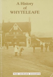
 A History of Whyteleafe, by Peter R. Skuse, August 1987. A5, iii+129 pp, 3 maps & plans, numerous b/w photographs, tables of house names, statistics, etc., advertisement reproductions. Perfect bound. ISBN 0 900992 29 8.
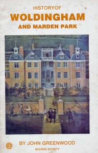
History of Woldingham and Marden Park, by John Greenwood, 1976. A5, 44 pp, 4 maps, 15 illustrations by E. F. Bishop, Kathleen Lewis, Janet Ross, & the author. Family trees. Staple bound.
If Stones Could Speak / History from Sanderstead Churchyard, by Joy Gadsby, [March] 2010. 20.5 x 25.7 cm (10 x 8 inches), 138 pp, numerous b/w & colour illustrations. Perfect bound. ISBN 0 900992 45 2. Based upon a series of articles (‘Tales from Sanderstead Churchyard’) in Bulletin 159, February 1995, and subsequent issues.
Indexes to Local History Records & Bulletins. See separate list below.
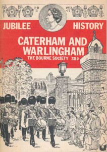 Jubilee History / Caterham and Warlingham / The Bourne Society, 1977. Chapters by Jeoffry Spence, P. E. Dimmock, R. J. Clarke and Arthur Beadell. 13 x 18.3 cm, 39 pp, 25 b/w illustrations by local artists. Staple bound. This is a reprint (with new Forewords) of a booklet given to schoolchildren in May 1953, originally entitled The Urban District of Caterham & Warlingham / A Souvenir to Mark the Occasion of the Coronation of H. M. Queen Elizabeth II. The reprint lacks the original folding map.
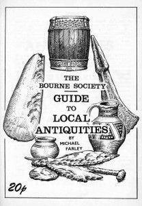
Local Antiquities / A Guide prepared by Michael Farley [on cover: Guide to Local Antiquities], n.d. [1972]. Notes by Mary Saaler; illustrations by E. F. Bishop & Lesley Ketteringham; Foreword by James Batley. A5, 51 pp, 10 line drawings, folding map (by Peter Kench), index, bibliographies. Staple bound. (Map is dated August 1970 but back cover has advert for Vol. XI of LHR, 1972.)
Old Caterham Illustrated [on cover: Old Caterham Illustrated in drawings and paintings], by Gwyneth [Margaret] Fookes, [April] 2023 [100 copies]. A4 landscape, [8] + 70 pp, 70 plates, most in colour, with captions. Introduction by the author. Foreword by Roger Packham. Typeset by Robert Warner. Perfect bound. ISBN 978 0 990992-85-8.
 Raffles and Rupert Davison – The Ideal Home, by Jan Ward, [June] 2016. 21 x 25.4 cm (8 x 10 inches), [x] + 113 pp, 125 illustrations inc. photographs (50 in colour), line drawings, sketches, plans, views, portraits, etc. Appendixes inc. timeline & bibliographies. Perfect bound. ISBN 978 0 900992 77 3.
Rectors of Coulsdon Surrey 1224-1950 / Including Clergy of Devolved Parishes 1871-1950 [listed in title], by Daphne Palmer, [June] 2013. A4, [ii]+147 pp, numerous maps, line drawings, engravings, b/w illustrations. Index of clergy. Perfect bound. ISBN 978 0 900992 74 2.
Richard Kearton’s Surrey Field Notes 1900-1927, transcribed by Gwyneth Fookes, foreword by Brian Thomas, [May] 2020. 21 x 25.4 cm (8 x 10 inches), xiv+136 pp, 2 maps, numerous photographs (b/w & colour). Appendixes by Cherry Kearton, jnr. Bibliography. Perfect bound. ISBN 978 0 900992 80 3.
Robert Lowe and “Sherbrooke” / The Career and Life of Robert Lowe, LL.D., D.C.L., G.C.B. Viscount Sherbrooke, 1811-1892, and his Home at ‘Sherbrooke,’ Salmons Lane, Warlingham (now Whyteleafe) Surrey [on cover: Robert Lowe and ‘Sherbrooke’], by Ruth Sear, 1999. A5, 39 pp, 22 engravings, photographs and line drawings, 1 map. Staple bound sheets; printed to order. No ISBN allocated. A reduced version is found in LHR, 39, 2000.
Rosie Remembers / Memories of a Coulsdon resident born in 1916 [on title page: and living there most of her lifetime], by Rosie Watts née Huggett (assisted by her daughter Jackie Colman), 2001. A5, [iv] + 76 pp, 34 b/w photographs. Collected from articles in LHR and Bulletin, with additional material. ISBN 0 900992 55 7.
 Sanderstead Servicemen and Civilians who died in Two World Wars, by Brian Roote, February 2012. A5, v+106 pp, numerous b/w photographs. Perfect bound. ISBN 978 0 900992 71 1.
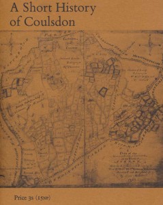
A Short History of Coulsdon / Based on material collected by the Bourne Society for a history of Coulsdon being prepared for publication, by U[na] Broadbent, ‘Published by the Bourne Society and Sponsored by Wates Limited’, London, 1970. A5, 31 pp, 7 photographs, 3 maps. Staple bound within brown card. See also Coulsdon / Downland Village.
 The Soldiers of Caterham: see (A) Directory of the Soldiers of Caterham.
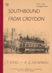
Southbound From Croydon, by J[ohn] T[hornton] King and A[nthony] G. Newman. ‘An Omnibus Society Publication in conjunction with the Bourne Society’. [Title on inside cover: ‘Southbound from Croydon’ / Being a record of local tram, bus and coach stage services in the Coulsdon & Purley and Caterham & Warlingham District Council areas from the end of the 19th century to the close of 1964], 1965. 17.2 x 24.1 cm, ii+190 pp, map, 12 b/w photographs. Perfect bound under red cloth spine. Back cover advertisement for LHR, Book IV, 1965.
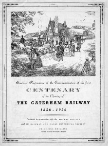 Souvenir Programme of the Commemoration of the first Centenary of the Opening of The Caterham Railway 1856-1956, [pub. by] The Bourne Society & Railway and Canal Historical Society, 1956. Text by Jeoffry Spence (chairman of the Organising Committee). 20 pp, of which 13 are advertisements by local businesses. Large format, staple bound.
A Surrey Childhood in the 1930s and 1940s, by Muriel Neal (née Hunt), [March] 1999. A5, [ii]+81 pp, b/w photographs. Perfect bound. ISBN 0 900992 49 2.
The Surrey Hills / A Guide to the Caterham Railway and its Vicinity / Republished with Illustrations, [November] 2003. A5, [92] pp, maps, b/w illustrations. A facsimile of the undated second edition of a guide first published in 1866, to which are added a Foreword and 42 full-page illustrations, mostly taken from early 20th-century postcards. The original page numbering is retained while the illustrated pages are not numbered. Includes a detail from a map of the ‘Caterham Park Estate’ [Caterham Valley] in 1870, two advertisements, and a railway timetable for October 1866. Composed by Robert Warner and Gwyneth Fookes. Perfect bound. ISBN 0 0900992 56 5.
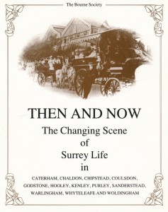 Then And Now / The Changing Scene of Surrey Life in Caterham, Chaldon, Chipstead, Coulsdon, Godstone, Hooley, Kenley, Purley, Sanderstead, Warlingham, Whyteleafe and Woldingham, [November] 1986; reprinted 1987. Produced by the Photographic Group of the Bourne Society under the leadership of Grahame W. Brooks. Foreword by Sir Geoffrey Howe. Introduction by Dorothy Tutt. 20.5 x 25.4 cm, 96 pp; map, index; photographs with descriptive captions, approx. 78 pairs of which compare ‘then’ with ‘now’. ISBN 0900992 28X.
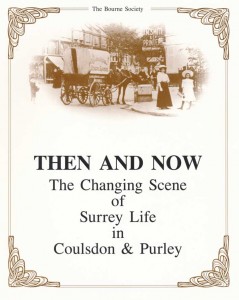
Then And Now / The Changing Scene of Surrey Life in Coulsdon & Purley, 1989. Produced by the Photographic Group of the Bourne Society under the leadership of Grahame W. Brooks. Foreword by Councillor Stanley E. Littlechild. Introduction by Dorothy Tutt. 20.5 x 25.4 cm, 96 pp, 2 maps, photographs with descriptive captions, approx. 85 pairs of which compare ‘then’ with ‘now’. ISBN 0900992 30 1. [A sequel to the above].
 A Tour of the Windmills and Watermills around East Surrey, compiled by Gwyneth Fookes, [October] 2007. A5, [iv]+36 pp, 44 photographs, line drawings & engravings. Staple bound. ISBN 978 0 900992 84 1.
Village Histories series. Series editors Gwyneth Fookes & Roger Packham. All vols 21 x 25.4 cm (8 x 10 inches), illustrated with b/w maps, line drawings & photographs; perfect bound. Single or multiple chapters by specialist authors. Bibliographies follow chapters.
1. Purley, ed. by Andy Higham, [April] 1996. Reprinted 2000 & [March] 2005. viii+191 pp, 191 illustrations. ISBN 0 900992 41 7.
2. Caterham, ed. by Gwyneth Fookes, [August] 1997. Reprinted 1998, [March] 2005 & [December] 2013. x+175 pp, 174 illustrations. ISBN 0900992 65 4.
3. Sanderstead, ed. by Joy Gadsby, [October] 1998. Reprinted [February] 1999 & [February] 2008. viii+172 pp, 171 illustrations. ISBN 0 900992 44 1.
4. Warlingham, ed. by Dorothy Tutt, [October] 1999. Reprinted [July] 2004 & [October] 2011. viii+174 pp, 172 illustrations. ISBN 0 900992 47 6.
5. Coulsdon, ed. by Ian Scales, [September] 2000. Reprinted [March] 2003, [November] 2008 & [March] 2015. viii+177 pp, 175 illustrations. ISBN 0 900992 50 6.
6. Kenley, ed. by Grahame Brooks, [March] 2002. Reprinted [March] 2005. viii+191 pp, 190 illustrations. ISBN 0 900992 57 3.
7. Chaldon, ed. by Gwyneth Fookes, [August] 2002. Reprinted [March] 2005 ?? x+192 pp, 190 illustrations. ISBN 0 900992 63 8.
8. Chelsham and Farleigh, ed. by Roger Packham, [October] 2004. viii+183 pp, 182 illustrations. ISBN 0 900992 64 6.
9. Whyteleafe, ed. by Gwyneth Fookes & Roger Packham, [March] 2006. viii+193 pp, 190 illustrations. ISBN 0 900992 67 0.
10. Woldingham, ed. by Gwyneth Fookes & Roger Packham, [February] 2013. x+176 pp, 176 illustrations. ISBN 978 0 900992 69 8.
11. Chipstead / [on title page:] Including Mugswell, Hooley and Netherne-on-the-Hill, ed. by Jon Grant & Liz Bonsall, [spring] 2022. vii+169 pp, 166 illustrations & maps, most in colour. ISBN 978 0 900992 81 0.
Villagers – Five Shillings / Sanderstead’s transformation from agricultural community to London suburb and its effect on the village cricket club, by Harley Sherlock / With a foreword by Lord [Colin] Cowdrey of Tonbridge CBE, [January] 2001. A5, 75 pp, illustrated. ISBN 0 900992 54 9.
The Way We Were / A Bourne Society Book of Days, by John D. Matthews, 1995. A5, [iv]+88 pp, 28 illustrations, 1 map, bibliography. Perfect bound. ISBN 0 900992 37 9.
William Garland Soper / 1937-1908 / Father of Modern Caterham / – WHAT THE PAPERS SAID – , ed. by Gwyneth Fookes, [July] 2009. 21 x 25.4 cm (8 x 10 inches), viii+105 pp, numerous b/w illustrations. Perfect bound. ISBN 978 0 900992 59 9.
Indexes to Local History Records and Bulletins:
 The Bourne Society / Index / Local History Records and Quarterly Bulletin 1956-1971, compiled by K[enneth] M. Newbury, October 1971. A5, 32 pp.
The Bourne Society / Index II / Local History Records and Quarterly Bulletin 1972-1980, compiled by K. M. Newbury, February 1981. A5, 20 pp.
The Bourne Society / Index III / Local History Records and Quarterly Bulletin 1981-1990, compiled by K. M. Newbury, 1992. Small A5, 15 pp.
In the same year (1992) a 4-page major subject index covering LHRs 1 to 30 appeared in LHR volume 31.
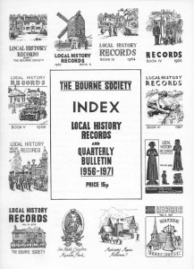
The Bourne Society / Index to Local History Records [1-45] – 1962-2006 and Bulletins [1-202] – 1956-2005, compiled by T. D. K. Pearce, [November] 2006 [on cover: the Society’s Golden Jubilee Year]. Reprinted August 2007. A5, [vi]+335 pp. Includes separate Index to Book Reviews & Index to Contributors and Article Titles, in all totalling around 13,000 items. Perfect bound. No ISBN allocated.
The Bourne Society / Index to Local History Records / Volumes 46 to […] / February 2006 – […], compiled by Raymond Howgego, 2019-[…]. A5, 70+ pp. Staple bound. No ISBN allocated. Some copies reprinted after each new issue of LHR. Some bound copies circulated (e.g to libraries and East Surrey Museum); otherwise printed on demand. Constantly updated editions are freely available on this website and may be printed for personal use.
Index of Subjects covered by Bourne Society Local History Records and Bulletins. A very basic list of around 450 indexed items, covering the period from 1956 to November 1999, printed on five stapled A4 sheets. Apparently circulated with an issue of the Bulletin for late 1999 or early 2000.
Historic Map Reproductions
‘A Plan of an Estate within the Manor and Parish of Coulsdon in the County of Surrey together with the Boundary of the said Manor belonging to Thomas Byron Esqr Made in 1785 by Tho’ Bainbridge.’ Transcribed by E[ustace] F[rank] Bishop (1905-80) from the original held by the Borough of Croydon, 1975. Known as ‘The Bainbridge Map’. Paper size: 57.5 x 45.0 cm. No Bourne Society attribution, but listed in LHR, volume 18, 1979.
‘The Mannor of Portley in Surrey.’ Transcribed by E. F. Bishop from the original in the Surrey Records Office, 1968. Known as ‘The Portley Map’. Paper size: 31.0 x 40.7 cm. The original is undated but the map was commissioned by Sir Isaac Shard, who arrived in 1715, and the surrounding estate bears the name of Richard Rowed who died in 1721. No Bourne Society attribution but see the covering article by Marguerite Gollancz in LHR, 8, 1969, pp. 35-8.
‘Surveyed for Edwd Budgen / A Farm called Ham Scituate in the Parishes of Bletchingly Nutfield and Horley also another Farm Called Ridghaw scituate in the Parish of Nutfield in ye County of Surry. In the Occupacon of Mr Edward Russell / October 1723.’ Surveyed by John Harding. ‘Published by the Bourne Society with the kind permission of R. D. Wilderspin Esquire, Nutfield.’ No reproduction date or other attribution, but attributed to the Bourne Society in LHR, vol. 34, 1995, p. 51 [‘published a few years ago’]. Curiously, no advertisement for this map was ever published. The map covers the area now occupied by Redhill Aerodrome. Paper size: 45.0 x 64.2 cm.
‘A Map of Court Lodge & Red-Hall Farms in the Parish of Catterham in the County of Surry Belonging to Henry Rowed / November 1736.’ Transcribed by E. F. Bishop from the original, 1968. Known as ‘The Rowed Map’, it measures 87.5 x 50.5 cm (map size within border lines). The map was printed at least three times by the Bourne Society on different paper sizes: 89.0 x 58.5 cm, 63.3 x 40.8 cm and 57.0 x 36.7 cm. The first of these appears to represent the true size of the original but is very scarce, with only one copy known (in the present author’s possession). The second, which is the most common, gives a reduction from the original scale of 72.0 per cent (vertically) / 73.3 per cent (horizontally). A further reduction is found in Caterham in the Village Histories series.
‘A Plan of the Manor of Farleigh in the County of Surry 1768.’ Surveyed by William Chapman. No other attribution or date of reproduction [1980s?]. First advertised in LHR as a Bourne Society publication in 1986.
‘Plan of Kenley Farm In The Parish of Coulsdon In The County of Surry / A Freehold Estate Belonging To Joseph Hodgkins Esqr. Surveyed & Delin,d By Isaac Messeder 1762.’ Transcribed by E. F. Bishop, 1976. Paper size: 26.0 x 43.2 cm. No Bourne Society attribution, but listed in LHR, volume 18, 1979.
Note: A hand-coloured version of the Kenley Farm map, together with other manuscript maps by E. F. Bishop, several of them in colour, are found in the East Surrey Museum. Only two of the above maps carry a Bourne Society attribution, but all are known to have been published by the Society. In addition, all of the above were found with a price pencilled on them, confirming that they were intended for sale to the general public.
Information Sheets & Maps, Leaflets, Guided Walks, etc.
‘My Seven Wonders of Tandridge’, by James Batley. Sheet reprinted from the Caterham News, 10 August 1974. Text + 7 line drawings by Kathleen Lewis, Caterham Art Group. Backed with ‘Sites of Tandridge District.’ ‘Specially drawn by Peter Kench.’ Map showing 79 numbered monuments identified in text on right-hand side. Undated (1974?).
‘A heritage that spans the centuries’, by James Batley. Sheet reprinted from the Croydon Advertiser, 21 May 1965. Text + map by L. C. Muggeridge + 3 line drawings by Kathleen Lewis. Backed with ‘Local Monuments in the Bourne Society Area.’ Map showing trackways, Roman roads, villas, churches, etc., together with 99 numbered monuments, all of which are identified in text below. [1965?].
‘Wild Life of Croydon’s Countryside’, by Tony Holcombe & Raymond Clarke. Double-sided sheet, reprinted from the Croydon Advertiser, 6 March 1970. Includes ‘Bourne Society Countryside Map’ + descriptive text, line drawings of birds and animals.
‘Bourne Society Map to Local Antiquities’. Drawn by Peter Kench, August 1970 [printed 1972]. Small folding map bound into Michael Farley’s Guide to Local Antiquities (q.v.). Numbered monuments refer to those in the book.
‘Memorial to Sir Edward Banks‘. Broadsheet with line drawing by E. F. Bishop of the memorial stone in St Margaret’s Church, Chipstead. An enlargement of the drawing in Local History Records, vol. 12, 1973. [No surviving copy of this item was found. Listed in LHR, vol. 18, 1979].
‘Rowed Monument‘. Broadsheet with a line drawing of the Rowed-Wood monument in St John’s Church, Coulsdon, with notes. An enlargement of the drawing by E. F. Bishop in Local History Records, volume 10, 1971. [No surviving copy of this item was found. Listed in LHR, vol. 18, 1979].
‘The Caterham Railway. Published by the Bourne Society / To mark the 150th Anniversary of the opening of the line / August 2006.’ Double-sided, triple-folded A4 sheet. Text, 3 images, map. ‘Text and sketch map by Nigel Harris & Gwyneth Fookes. Layout and typesetting by Robert Warner.’
‘Getting to Know Our Downland Villages. 1. Sanderstead’, by Joy Gadsby, 1997. Folded, double-sided A3 sheet. Text, route map, 9 line drawings [by Gwyneth Fookes]. A guided walk of 2 to 4 miles.
‘Getting to Know Our Downland Villages. 2. Godstone’, by Peter Fernée, 1998. Folded, double-sided A3 sheet. Text, route map, 11 line drawings by Gwyneth Fookes. A guided walk of 2½ to 4 miles.
‘Purley Historical Trail 2010.’ Double-sided, triple-folded A4 sheet. Text + 11 photographs & 1 watercolour in b/w, sepia & colour, mainly from postcards. A guided walk (length not specified) devised by Tim Kidd.
‘Old Coulsdon Historical Trail 2011.’ Double-sided, triple-folded A4 sheet. Text + 12 photographs in b/w, sepia & colour, mainly from postcards. A 2-hour guided walk devised by Paul Sandford. Leaflet design by Robert Warner.
‘Smitham Bottom Historical Trail 2011.’ Double-sided, triple-folded A4 sheet. Text + 17 photographs & 1 watercolour in b/w, sepia & colour, mainly from postcards. A 2-hour guided walk devised by Paul Sandford. Leaflet design by Robert Warner.
‘Godstone Ponds Historical Walk 2012’. Double-sided, triple-folded A4 sheet. Text + 15 photographs, colour & b/w, 2 paintings, 2 b/w drawings. Walk devised by Gwyneth Fookes. Leaflet design by Robert Warner.
[Calendar for 1988]. A wall-hanging calendar of four pages on heavy card, featuring three months on each page beneath a contemporary colour photograph taken by Paul Sandford (1) or Grahame Brooks (3). Each photograph, printed on the reverse as a postcard, could be removed and used as such. This was the first and last Bourne Society calendar.